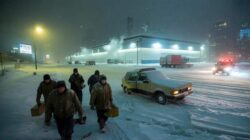
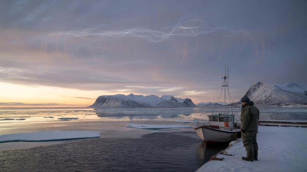
The sky above Tromsø, in northern Norway, does a strange thing in early February. It looks frozen and restless at the same time. The sun barely lifts itself over the horizon, casting a pale orange strip over a sea that used to be solid ice at this time of year, but now glistens dark and open. On the pier, a local fisherman I met last winter shrugged and told me he was catching mackerel where his grandfather once drilled holes for cod under the ice. He said the sea “feels wrong.”
Meteorologists are quietly saying the same thing about the Arctic sky this year. Something feels wrong.
Early February: the quiet month that isn’t quiet anymore
Ask veteran forecasters about February in the Arctic and they’ll describe a month that used to be predictable in a harsh kind of way. Deep cold, locked-in ice, storms following familiar tracks. A brutal but stable rhythm.

This year, forecast centers from Copenhagen to Seattle are watching model runs with furrowed brows. Long-range data hints at a strange cocktail: stubborn warmth over the Arctic Ocean, a jittery polar vortex high above, and a jet stream that looks like a loose thread about to snag on something. For specialists who live in the world of averages and probabilities, the word they’re using is simple, and slightly chilling: *critical*.
You can feel this shift most clearly in the numbers, even before you see it on the ice. Satellite records from the National Snow and Ice Data Center show that Arctic sea ice has spent recent winters skating near record-low levels, repeatedly. Late January into early February used to be the time the ice cover plateaued, like a deep breath held before spring.
Now that plateau is wobbling. Warm air surges are creeping higher into the Arctic Circle. Open water appears where solid ice once sat unwavering. In 2023, sensors picked up a spike of temperatures near the North Pole that climbed close to freezing while it was still polar night. That’s not a gentle anomaly. That’s a flashing warning light over the world’s thermostat.
This fragile moment in early February matters because the Arctic is not just a distant frozen cap. It behaves like a giant reflector and a cooling fan for the planet. When there’s enough bright ice, sunlight bounces back to space and the cold helps stabilize the jet stream. When the ice is thin or late-forming, the dark ocean absorbs heat, and that warmth leaks into the atmosphere.
Meteorologists fear we’re nearing a kind of tipping threshold, where one too-warm February doesn’t just shave a few centimeters off the ice. It reshapes weather patterns far to the south. The phrase some of them use in private is “losing the guardrails.” Once you hear that, it’s hard to un-hear it.
What forecasters are really watching in early February
In forecasting centers, the drama of this coming February isn’t a single storm or temperature record. It’s the alignment of several quiet dials that rarely move together. The polar vortex, that spinning mass of cold air 30 kilometers above us, has been showing signs of weakening and stretching. When that happens in late winter, frigid air can spill south while mild air flows north, punching into the Arctic.
Forecasters are watching for sudden stratospheric warming events, for blocked high-pressure systems over Greenland, for heat flux from the Atlantic that keeps the Barents and Kara seas more liquid than frozen. None of this sounds like headline material, yet these are the tiny hinges on which entire winters can swing.
Think of early 2018, when a disruption in the polar vortex spilled Arctic air into Europe and parts of North America. Media called it the “Beast from the East.” Streets in Rome saw snow; London buses crawled through ice. At the same time, much of the Arctic was oddly mild. That wasn’t a coincidence. It was a see-saw.
Cases like that have become more frequent in the last decade. A “warm Arctic, cold continents” pattern has popped up in multiple years, confusing people who look out their window at a snowstorm and wonder where global warming went. Statistically, those weird splits in temperature are showing up more often than they did when the Arctic was cooler and its ice more solid by February.
Climatologists are careful not to promise a single date when the Arctic “breaks.” That’s not how physics works. Instead, they talk about probabilities, about how the dice are being loaded. When sea ice is low at the very moment it should be near its maximum, the atmosphere behaves differently. Storms can travel unusual paths. Moisture can be pulled into places that are already vulnerable to floods.
This is why early February worries them so much. It’s like the rehearsal before spring, when the character of the whole season starts to set. If the Arctic enters that phase already unstable, it amplifies every nudge the climate throws at it. **We’re not just warming the planet; we’re rearranging how the planet works.**

What this means for our daily lives — and what we can actually do
So what can an ordinary person do with the knowledge that early February might be a critical test for Arctic stability? The first step sounds basic, but it has real weight: pay attention to the pattern, not just the headline. When you see stories about bizarre winter warmth in Alaska paired with monster snow in New York, connect those dots back to the Arctic.
At a practical level, follow seasonal outlooks from trusted meteorological agencies where you live. They often now include references to Arctic conditions, sea-ice anomalies, and the state of the polar vortex. Understanding these signals won’t change the weather in your town, but it can change how prepared you are for what’s coming over the next few weeks.
There’s also the quieter work of lowering the pressure we’re putting on this fragile system. No, you alone won’t save the polar vortex by changing a light bulb or skipping one flight. You’ve heard that line enough to be numb to it. Yet policies that cut fossil fuel use and protect intact ecosystems become much easier to pass when they don’t feel abstract.
That’s where the Arctic comes back in. When you talk to friends or family about climate, grounding the conversation in real, near-term stakes — “this strange winter we’re living through is tied to what’s happening up north” — often lands better than graphs for 2100. Let’s be honest: nobody really reads those reports cover to cover.
Scientists I’ve spoken to over the years sound most human when they step out of the graphs and talk about how this feels for them. Many grew up loving harsh winters, the kind that made your eyelashes freeze. They’re now watching their life’s work turn into a kind of triage.
“Early February is when I hold my breath,” one Arctic researcher told me. “If the ice doesn’t look right by then, I know the rest of the year will be playing catch-up with a system that’s already behind.”
- Follow real-time Arctic sea-ice maps from agencies like NSIDC or the Copernicus Climate Change Service to see how unusual this winter really is.
- Scan seasonal forecasts from your national weather service; look for mentions of the Arctic, polar vortex, or jet stream behavior.
- Bring these stories into local debates about energy, transport, or housing; link “faraway” Arctic shifts to the floods, storms, or price spikes you already see.
- Support journalism and science that explains these connections in plain language, not just technical reports.
- Talk about this with kids and teens without doom, framing the Arctic as a living system we’re still in time to protect.
A distant ice world that keeps knocking at our door
Stand on a windy city corner in early February and the Arctic can feel like another planet. You rush between meetings, juggle bills, think about weekend plans, and the idea of a “critical moment for Arctic stability” sounds like something from an academic conference you weren’t invited to. Yet the same currents of air brushing your face are tied to that distant, thinning ring of ice.
We’ve all been there, that moment when a freak storm wipes out travel plans, or a winter heat wave melts the snow overnight and leaves a muddy, unsettling stillness. Those aren’t random mood swings from the sky; they’re signals from a climate system losing its old balance. The Arctic is simply where those signals are loudest.
The plain truth is that the Arctic won’t crash in a single news cycle. It will keep changing in fits and starts, in quiet Februaries and noisy ones, as glaciers retreat and sea ice pulses in ever-weaker rhythms. What meteorologists are warning about this year is not a movie-style catastrophe. It’s the risk that we cross one more invisible line without noticing, shrug, and move on to the next headline.
Yet there’s another way to read this moment. A critical period is also a clarifying one. Knowing that these weeks matter sharpens the story. It nudges us to connect weather to climate, personal choices to policy, distant maps to the walk you take tomorrow morning when you look up at the sky and feel the air on your skin.
If early February brings odd warmth to the pole again, if the sea ice graph dips lower than it should, there won’t be sirens. There will be data releases, dry bulletins, maybe a viral image of cracked ice under a pink Arctic sunset. Behind that, though, sits a very simple question for all of us: how much instability are we willing to live with?
The Arctic is answering that question right now, in wind patterns and ocean currents and lines of code on a forecaster’s screen. The rest of the story depends on whether we listen — and what we choose to do with what we hear.
| Key point | Detail | Value for the reader |
|---|---|---|
| Early February as a “critical window” | Forecasters see this period as decisive for sea-ice extent, polar vortex behavior, and jet stream patterns. | Helps you understand why strange winter weather now often traces back to Arctic conditions. |
| Arctic shifts shape local extremes | Warm Arctic episodes can coincide with severe cold or storms in mid-latitudes through disrupted circulation. | Explains why your local winter can feel harsher even as the planet overall warms. |
| Practical ways to engage | Following Arctic data, reading seasonal outlooks, and linking these to local climate conversations. | Gives concrete steps to move from vague worry to informed, grounded climate action. |
FAQ:
- Question 1Why are meteorologists so focused on early February for the Arctic this year?Because this is usually when Arctic sea ice is nearing its seasonal peak and the polar vortex settles or destabilizes. Anomalies now can strongly influence the rest of the winter and the transition into spring weather patterns.
- Question 2Does a “critical moment” mean we’ll see immediate disasters?Not automatically. It means the probability of unusual events rises — like out-of-season storms, disrupted jet streams, or stronger temperature contrasts between regions. The impacts can unfold over weeks and months.
- Question 3How can warming in the Arctic cause cold spells where I live?When the polar vortex weakens or stretches, cold Arctic air can spill south while milder air moves north. That see-saw makes some regions freeze while the Arctic itself runs warmer than normal.
- Question 4Is the Arctic already past a point of no return?Some changes, like loss of thick multi-year sea ice, are hard to reverse on human timescales. Yet cutting greenhouse gas emissions can still slow the pace of change and reduce the risk of crossing additional tipping points.
- Question 5What can I realistically do about something happening so far away?You can stay informed, support policies that cut fossil fuels, back science and journalism on Arctic change, and talk about these links in your community. The Arctic may be distant, but the forces that shape it are tied directly to our energy, transport, and land-use choices.